

Know Every Acre
Of Your Land.
TerraMarker turns your phone into a custom mapping tool for your property, hunting lease, farm, or favorite backcountry spot, on crisp satellite, hybrid, or topo imagery.
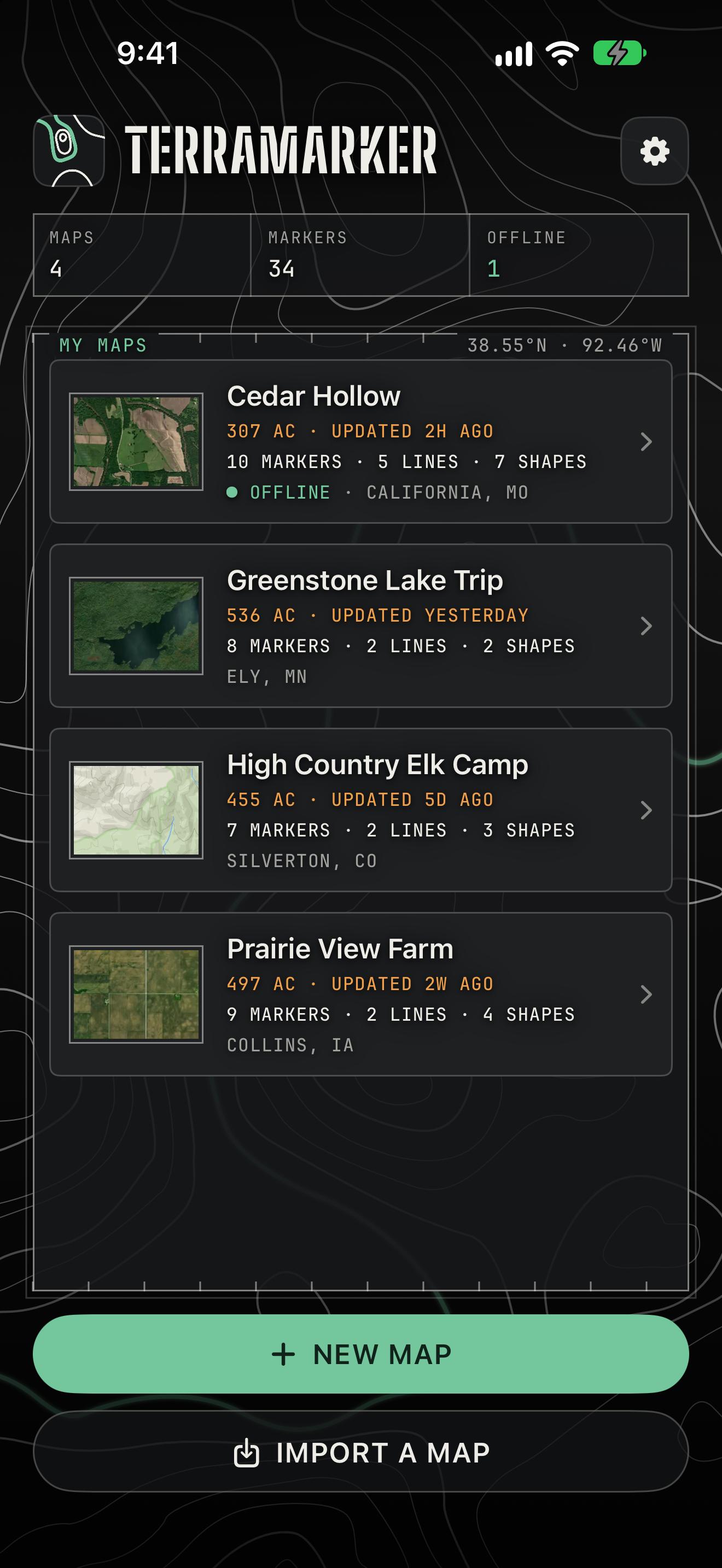
Legend
Everything you can put on your map. Every symbol here is something TerraMarker draws, measures, or carries for you.
Custom waypoints
Drop numbered markers or pick from 150+ icons for stands, cameras, gates, water, and more.
Lines & shapes
Trace trails, roads, rivers, and fences. Outline boundaries, fields, food plots, and timber.
GPS track recording
Record as you walk, even with the screen locked, and save the track straight to your map.
Instant measurements
Every line shows its length, every shape its acreage and perimeter. Imperial or metric.
Offline maps
Download your map area, imagery and all, so it keeps working with zero cell service.
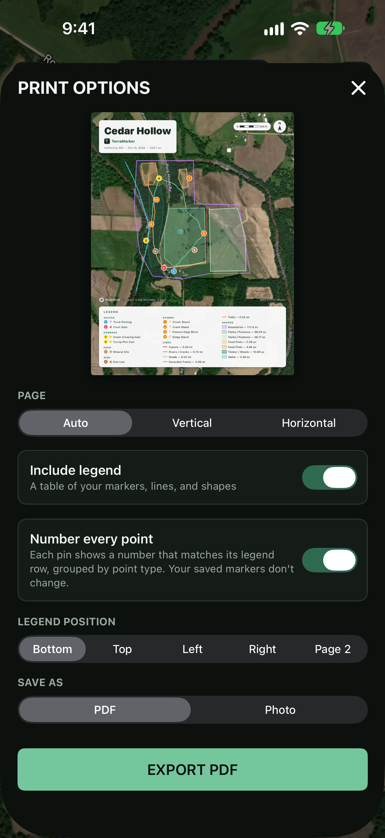
Print-ready PDF export
Export a professional map with a title block, north arrow, scale bar, and full legend.
Share & import
Send complete maps as a single file, or exchange GPX and GeoJSON with other mapping tools.
Five base map styles
Hybrid, Satellite, Outdoors/Topo, Streets, and Dark. Switch anytime per map.
Atlas
A lake trip, an elk camp, and the tools that keep a busy map in order. Same app, whatever ground you're covering.
-
SHEET 01 · LAKE
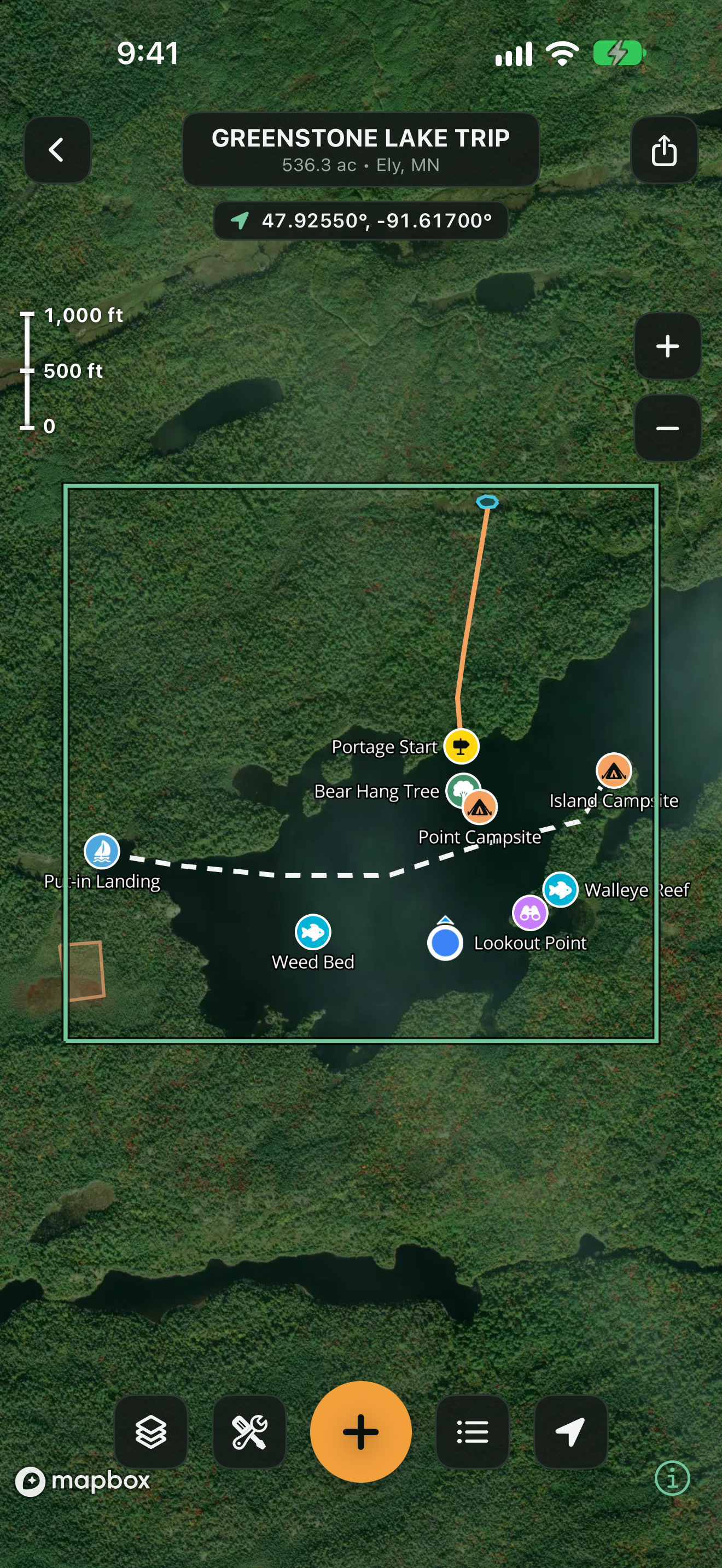
Greenstone Lake Trip
Portage, campsites, and the walleye reef, all on one map.
-
SHEET 02 · TOPO
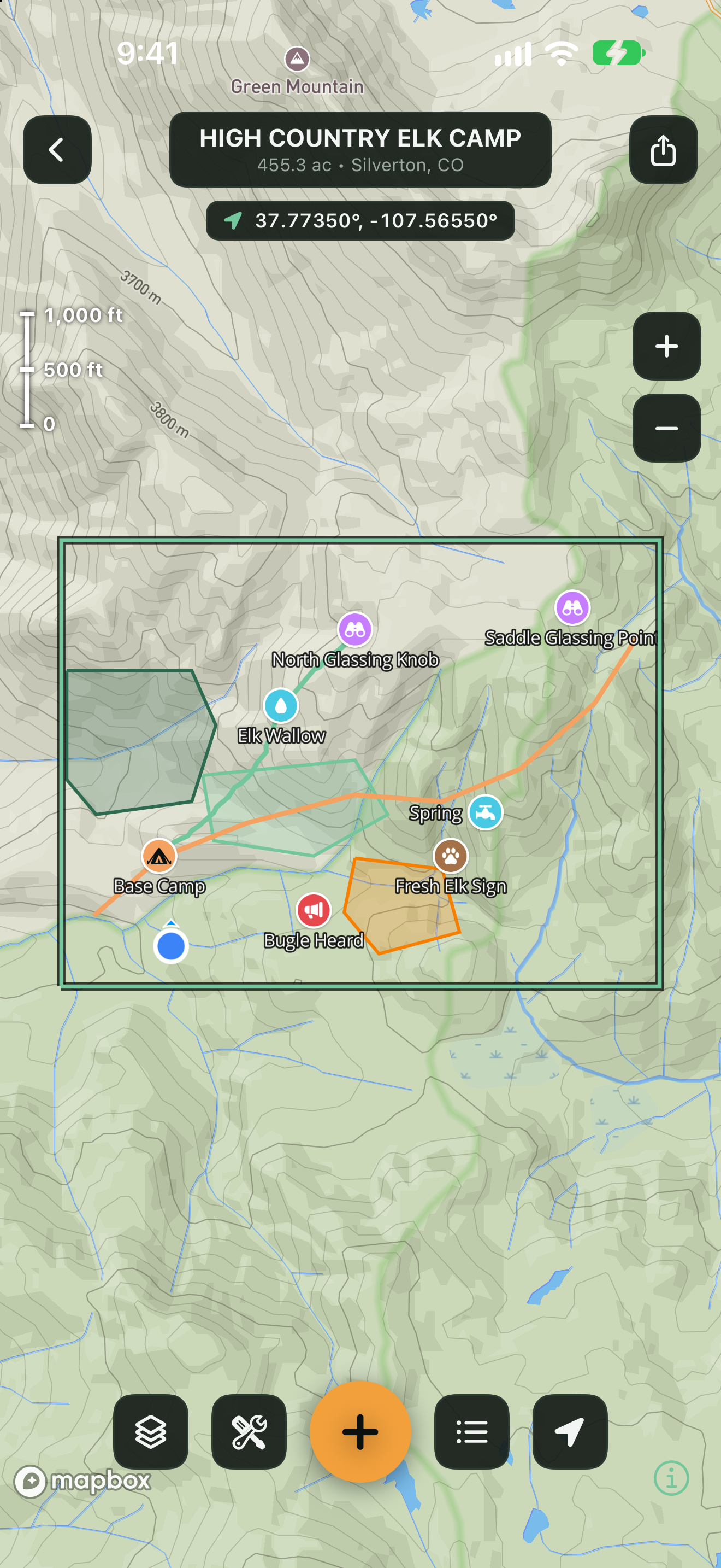
High Country Elk Camp
Contours under glassing points, wallows, and the way back to camp.
-
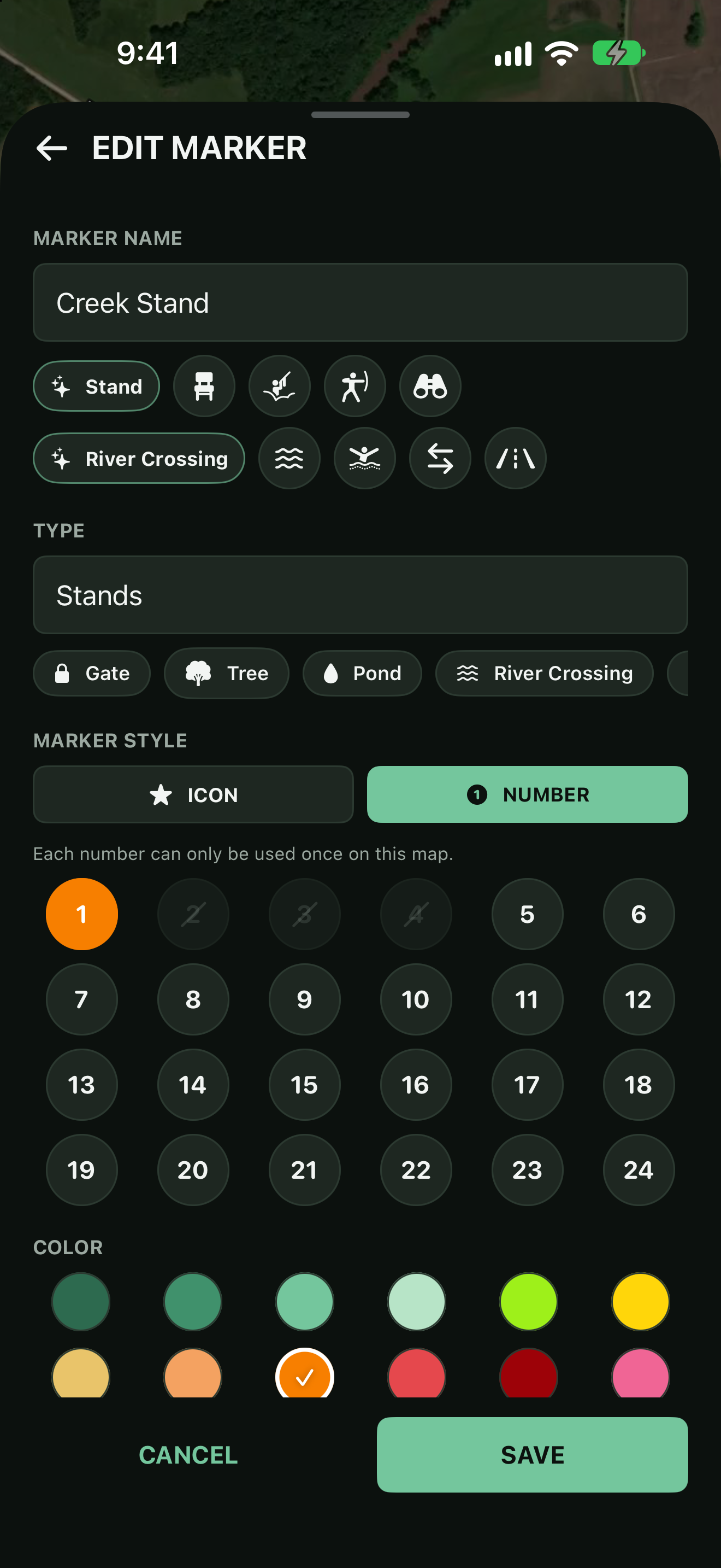
SHEET 03 · MARKER
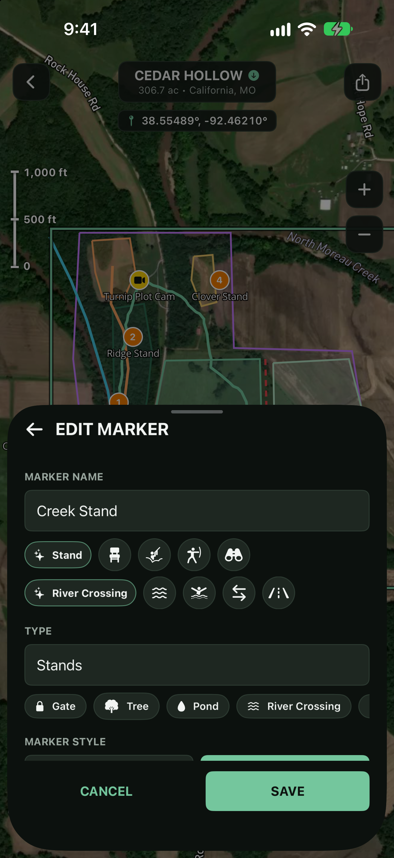
Edit Any Marker
Rename it, retype it, or swap its icon without leaving the map.
-
SHEET 04 · FILTER
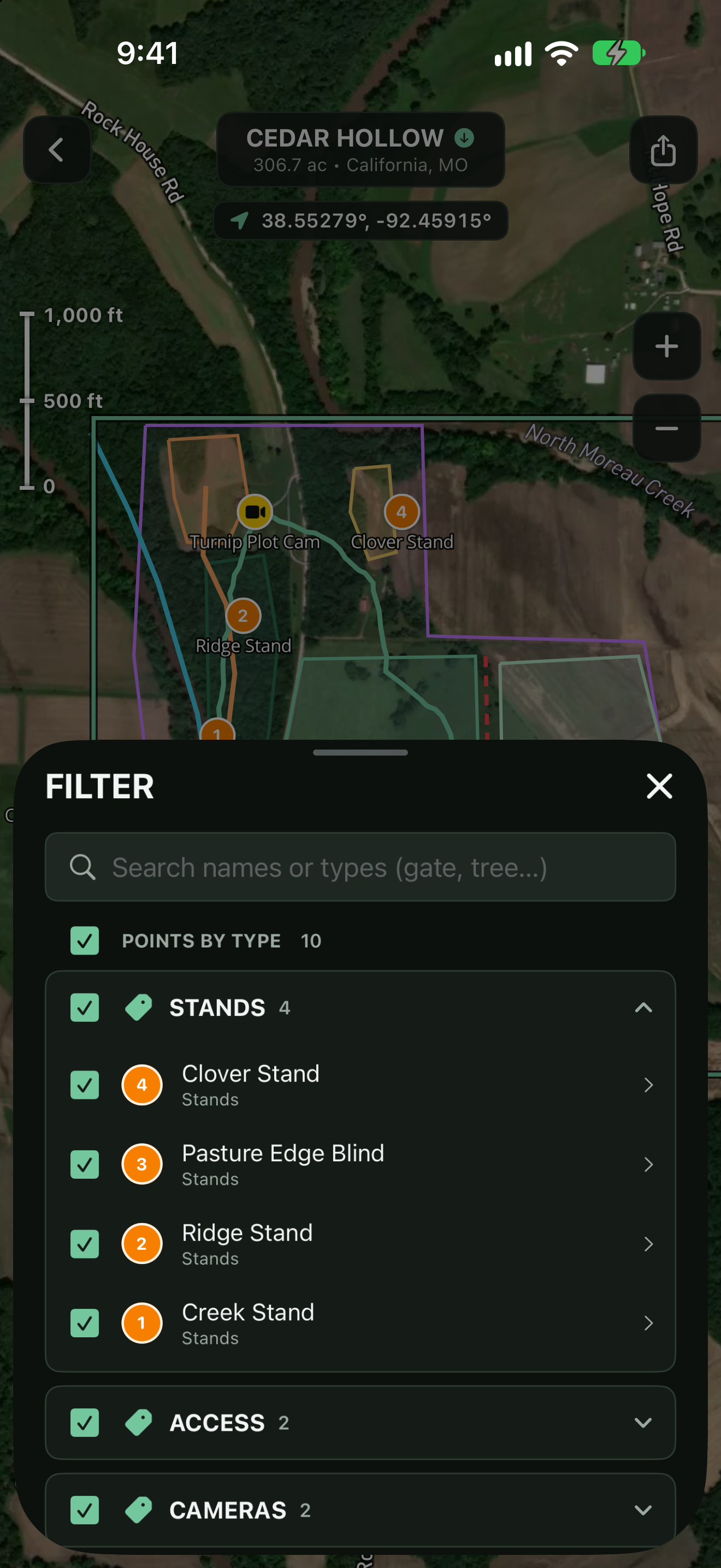
Filter by Type
Search every point and show just the stands, gates, or cameras.
Mark What Matters
Drop a pin on the camp, trace the trail to the ridge, name it, color it, done. Every marker, line, and shape is fully yours to customize.
- Numbered markers or 150+ searchable icons
- 24-color palette for every feature
- Categories that remember themselves
- Notes on any marker, line, or shape
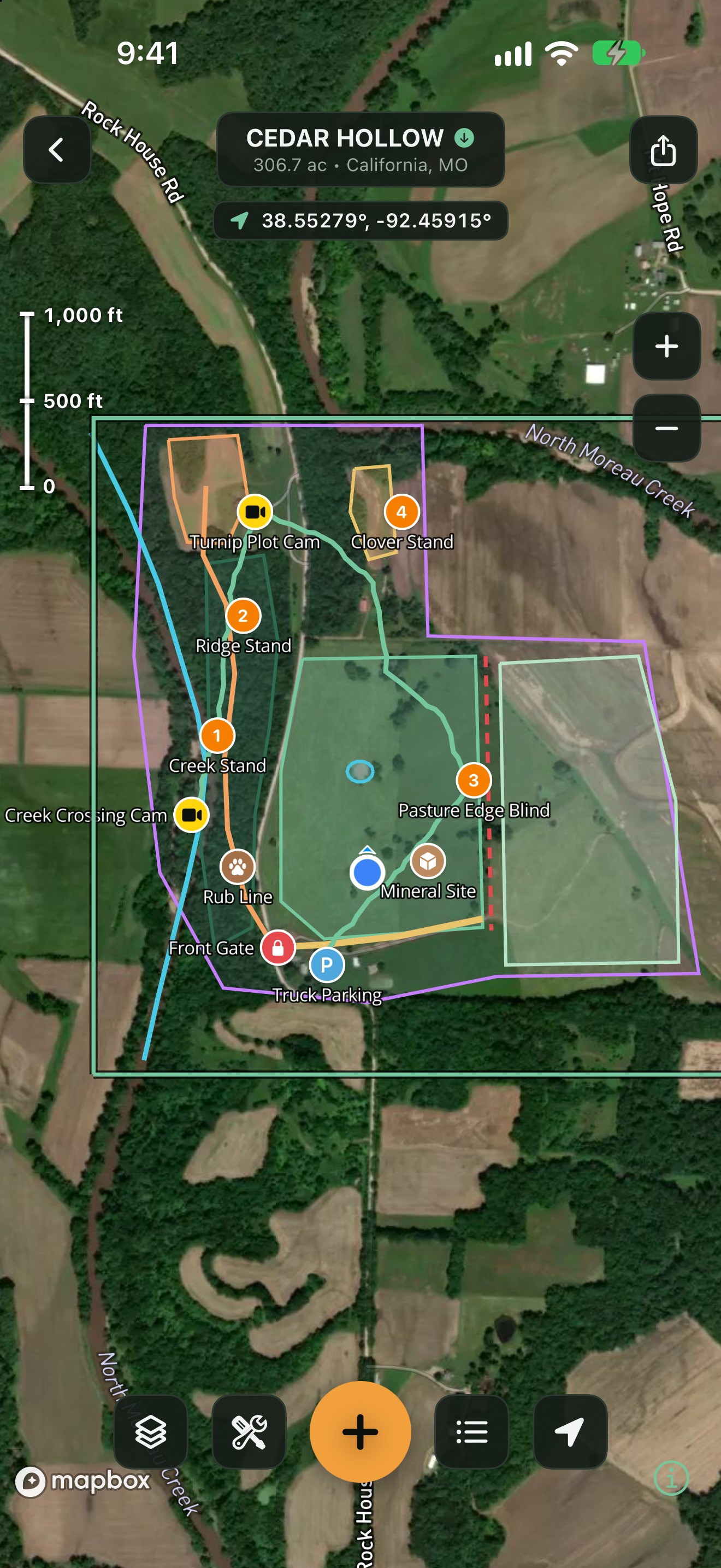
Tools Built for the Field
One tap opens everything you need out on the property. Record your path as you walk it, measure a stand of timber, or sketch in a new fence line.
- Record My Path: GPS tracking that runs in the background
- Measure area and distance on the fly
- Draw shapes and lines by tapping the map
- Drop a point exactly where you're standing
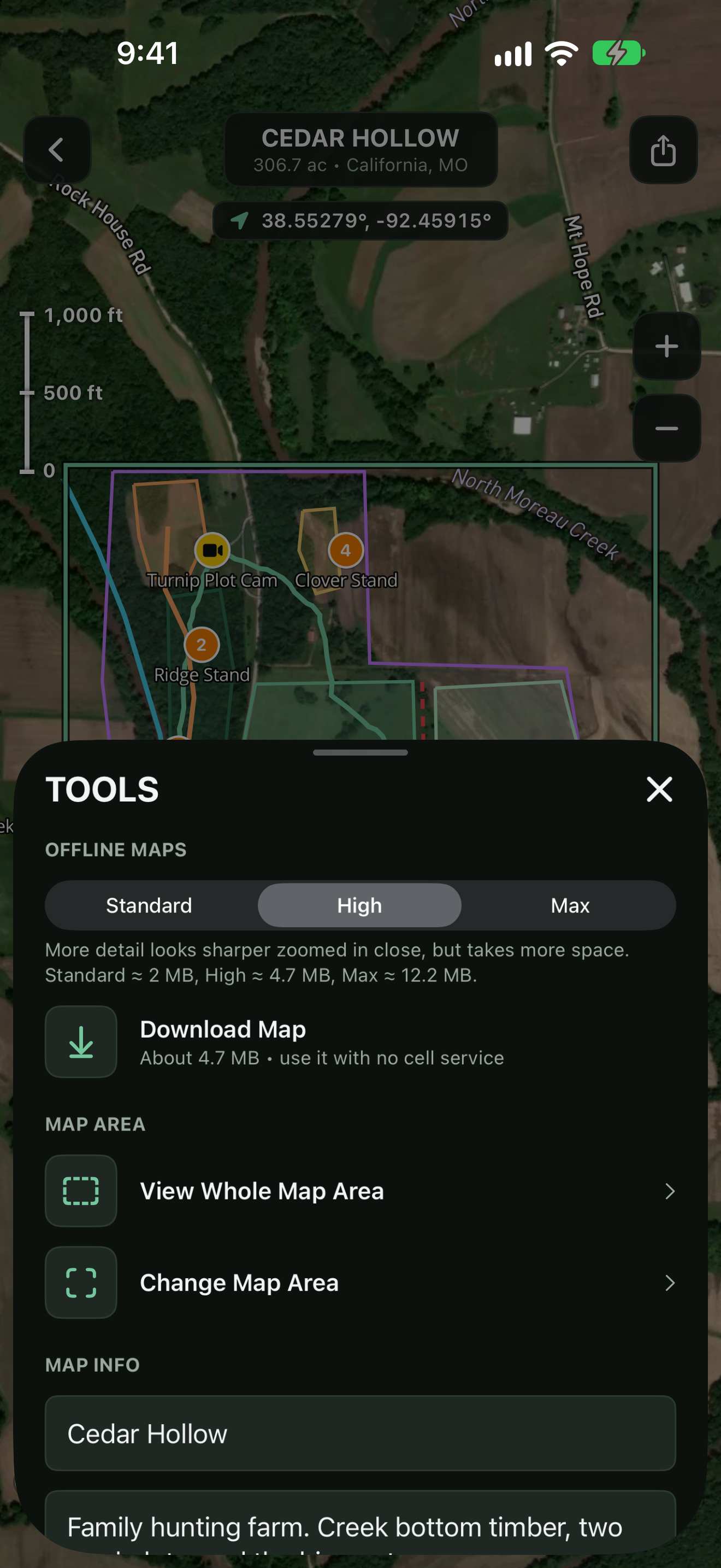
Set Your Area. Take It Anywhere.
Each map covers a set area you choose, with its acreage and location right in the header. Download it once and the imagery, markers, and tools all keep working where cell service doesn't.
- One-tap offline download per map
- Live acreage and place name for every map
- Scale bar and live coordinates on screen
- GPS keeps working without service
All Your Places, One Library
The home ranch, the lease, the elk unit. Keep a separate map for each, and move them wherever you need with sharing, importing, and exports that other tools understand.
- Unlimited maps, each with its own area and style
- Share a full map as one file
- GPX + GeoJSON export and import
- Print-ready PDF with legend and scale bar
A Map That's
Actually Yours
Most map apps show you the world. TerraMarker is for the piece of it you care about, with no subscriptions walling off your own land, no accounts, and your data on your device.